We’re pleased to announce the advancement of our support for the USPS OIG! The RISC team has published two new products that provide transparency for the work OIG completes in auditing and investigating the US Postal Service, the Closed Cases Dashboard and the Field Operations Review Team (FORT) storymap.
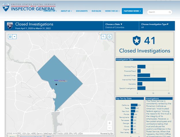
The interactive map-based Closed Investigations Dashboard aggregates investigations closed over the past two years by state, congressional district, and zip 3 and provides metrics on case types closed in those areas.
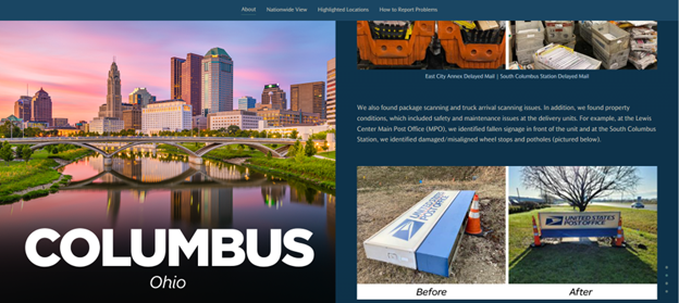
The FORT storymap provides highlights recent FORT visits. It groups visits into clusters that surround a major metropolitan area and includes images of issues discovered and resolved thanks to the efforts of the team.
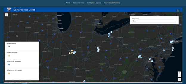
The FORT storymap also includes a nationwide map that shows all the sites visited by the FORT team and the Property Conditions Review team, FORT’s predecessor.
Both products were created on ArcGIS Online and are currently featured in the OIG’s public website in the featured work tab.
This information in no way is an endorsement by the USPS OIG.