The United States Marine Corps (USMC) Installation Geospatial Information and Services (IGI&S) program, known as GEOFidelis, needed a new imagery management strategy to support the transition to an enterprise implementation with increased analysis and dissemination capabilities. The program’s existing imagery holdings were managed locally in various storage formats without set naming conventions or common standards and procedures.

To help with this endeavor, geocgi worked with GEOFidelis to implement imagery management standards and design a corresponding solution based on ArcGIS Image Server and mosaic datasets. Initially, the team at geocgi focused on reducing the storage footprint of the 500 million acres of raster coverage that GEOFidelis had. Implementing mosaic datasets reduced storage space while allowing for easier user access, more visualization and analysis options, more flexible data management, improved performance, and enhanced dissemination of imagery and raster datasets across the USMC.
After the storage issues were remediated, the geocgi team analyzed the program’s existing raster datasets to determine gaps in coverage, currency, or format, as well as how users typically accessed raster data. This enabled the team to specify where to direct service resources and how they should be utilized. geocgi deploys and manages a fluctuating number of image services that it analyzes and reviews quarterly for usage to maintain server stability, averaging about 80 services per quarter. Based on frequency of use and importance, certain image services can be demoted, or stood down, to reduce storage costs.
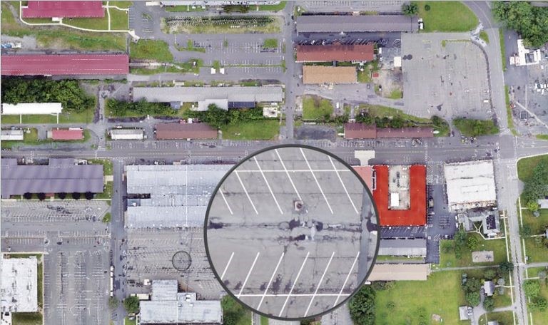
To better manage its imagery in the future, GEOFidelis is focused on acquiring imagery by leveraging collections from small unmanned aircraft systems (sUAS) and mosaic datasets. The goal is to figure out where GEOFidelis can save on costs for imagery while still meeting the program’s requirements for refreshing imagery. To this end, GEOFidelis is concentrating image capture on areas that have changed rather than on entire installations. This allows imagery updates to be delivered to end users quickly to support functions such as emergency management, facilities management, and construction. In addition, the sUAS technology and mosaic datasets support on-the-fly processing, which makes it possible to get new imagery acquisitions to decision-makers without delay.
Through scripting and batch process development, geocgi has increased the raster services that are available to the USMC by 588 percent and improved service load times by 29 percent.