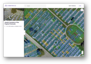
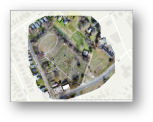
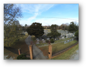
This past winter our sUAS team worked on a project with Chronicle, a digital cemetery management software company, to capture aerial imagery, digitize, and overhaul the geospatial management of a historic cemetery on the Virginia Peninsula. Cemetery management has been living in the past with spreadsheets and old drawings to manage their property. Chronicle has created an efficient, scalable web-based platform for cemetery management that is being adopted by many cemeteries in the U.S. and other countries to improve land management practices. Our team leveraged a DJI Inspire using Esri SiteScan for flight planning and Esri’s Drone2Map post-processing software to create the final orthomosaic product. We were proud to play a part in this project and are looking forward to the next cemetery mapping project with Chronicle. Read more about the project in Chronicle’s article here.
geocgi’s support was described as “providing stunning and seamless, high quality visuals that exceeded our expectations at Chronicle”