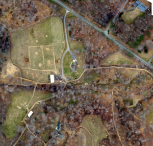
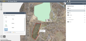
Earlier this year our sUAS team traveled to rural Virginia to capture and create high-resolution aerial imagery at a farm nearby. The team launched our Birds Eye View FireFLY Pro 6, equipped with a Sony a6000 digital camera, and captured 567 images over the course of the 22-minute mission. With the help of AeroPoint Ground Control Points (GCPs) dispersed over the farm and the on-board GPS unit, the team was able to bring the raw images back to office to be stitched together in Esri’s Drone2Map with a horizontal accuracy of approximately 1.7 cm. The resulting mosaic imagery was processed in a little over an hour and was delivered with an average Ground Sample Distance (GSD)of 2.2cm and published as hosted Tile Layers through Portal for ArcGIS. The mission also enabled the creation of a detailed Digital Surface Model (DSM), Digital Terrain Model (DTM), and 1-foot elevation contours. To learn more about this mission, please get in touch with us at sUAS@geocgi.com.