we are
Collaborators / Strategists / Globetrotters / Competitive / Loyal / Accountable / Equals / Pet-Friendly / A Somewhat Motley Crew / Honored to Do What We Do / Moving Forward (So Keep Up)
We pride ourselves on not losing our focus. We started out and remain GIS experts (or geeks. . . depending on your perspective). Since 2006, we’ve evolved into a world-class and world-wide service provider of multiple disciplines. We are a talented, hardworking group that share values and characteristics that drive client, professional, and personal success.
Collaborators / Strategists / Globetrotters / Competitive / Loyal / Accountable / Equals / Pet-Friendly / A Somewhat Motley Crew / Honored to Do What We Do / Moving Forward (So Keep Up)
Your Average Joes / Generalists / Greedy / Afraid to Speak Up / Hierarchical / Wizards / Mean / Entitled / Going to Waste Your Time / Party Poopers
For over a decade it has been an honor to serve the men and women who risk it all. The clients we serve have a mission that exceeds all others. We aid them through hard work, strategic execution, and a genuine concern for their business and their resources. We are proud to continually expand our service offerings while remaining true to our passion.
Geospatial information is increasingly being used for data driven decision making, resulting in a reliance on geospatial programs to store, manage, and disseminate relevant and accurate geospatial data to stakeholders. Effective geospatial program management facilitates a geospatially enabled environment.
Our principally GIS-focused service offerings ensure that we remain adept in the latest software and industry trends, resulting in innovative solutions for long term program success and viability.
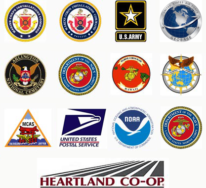
geocgi supports the United States Marine Corps (USMC), U.S. Air Force, and U.S. Army GIS programs at the Headquarter, Region, and Installation levels – both Continental United States (CONUS) and Outside the Continental United States (OCONUS) – leading to proficiency in all aspects of coordination and management of an enterprise geospatial program.
geocgi personnel specialize in the establishment of strategic plans; the implementation of policies, procedures, and communication strategies; and the achievement of mission objectives. Related geospatial program management experience includes:
Clients use spatial data to drive many of their important business decisions. Spatial data supports visualization and analysis to study relationships, observe patterns, and provide insight to organizations. We leverage unique domain knowledge with data sources, techniques, and workflows involved in data collection including but not limited to:
With organizational “buy in” and high accuracy, geospatial data can significantly improve decision making. Since 2006 geocgi has engaged with Department of Defense (DoD) SME’s – establishing credibility, expanding knowledge, and cultivating relationships at all levels. We are fluent in the geospatial data standards that translate functional requirements into authoritative, useful data for products, services, and analyses.
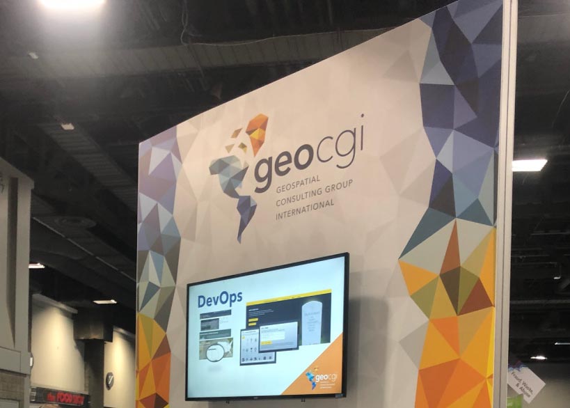
Whether you call it “DevOps” or “DevSecOps” the tight integration of security protocols within the application development lifecycle streamlines and expedites the delivery of applications and services to clients. As applicable, we apply the technology across a wide range of projects.
geocgi develops and maintains Arlington National Cemetery (ANC) & Army National Military Cemeteries (ANMC) Website Development Operations & Maintenance (O&M) web presence, including custom web applications using the ASP.NET stack and DNN Content Management System (CMS). We perform rigorous requirements gathering to ensure systems are hardened and STIG compliant throughout the development and release cycles. Custom applications include: Headstone Designer, Events and Ceremonies, Multi-Media Blogs and Responsive Designs.
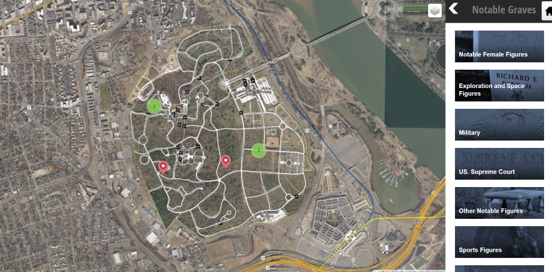
ANC Explorer is the cemeteries interactive map and grave finder. Developing in HTML 5 and AngularJS, while incorporating technology from Leaflet, MapBox, and ESRI, we provided a seamless and secure mapping and visualization experience for visitors on the web, mobile, and kiosk platforms.
geocgi stood up a cluster of secure cloud-based Esri application servers to quickly and securely analyze drone imagery collected for the Installation Geospatial Information & Services (IGI&S) Common Installation Picture (CIP) Data Collection and Standardization for Headquarters, Department of the Army (HQDA) effort that we have headed for nearly three years.
geocgi built a secure cloud-based application development environment, utilizing IaaS technology for Marine Corps Installations Pacific (MCIPAC) IGI&S application development efforts. Through this environment, the client and our developers access, build, test and push hardened STIG compliant applications all siloed in a safe environment.
Utilizing ASP.NET framework and an MVC (model-view-controller) architecture, geocgi implemented creative and secure solutions for data visualization inside desktop and web-based applications within the USMC Critical Asset Management System (CAMS) for the USMC Mission Assurance Development Lab (MADL). Additionally, using GEOFidelis assets, geocgi integrated a GIS module into the system using Esri software developers kit (SDK).
An enterprise GIS provides broad access to geospatial data and applications throughout the organization. The combination of geospatial enterprise technology and Web GIS provides applications and tools to end users for analysis and visualization. Organizations can use dynamic geospatial data within custom enterprise solutions to better collaborate, communicate, and solve their unique problems. Web GIS platforms are ideal decision-making tools within an organization because they enable employees, stakeholders and subject matter experts. Whether in the office or out in the field enterprise technology allows your organization to access, edit, and share relevant and timely data, maps, applications, and workflows.
Geospatial Enterprise and Web GIS enable organizations to provide broad access to authoritative GIS data. geocgi is committed to developing GIS professionals that exceed the requirements of implementing this evolving technology; and focus on innovation in GIS design and incorporating related technologies.
Enterprise: ArcGIS Enterprise (ArcGIS Server + Server Extensions, Portal for ArcGIS, ArcGIS Data Store, ArcGIS Web Adaptor)
Web GIS: Portal for ArcGIS and ArcGIS Online (Web AppBuilder, Story Maps, Mobile GIS, 3D Web Scenes)
Geospatial Databases: MS SQL Server, Oracle, PostGRESQL, MySQL
Geospatial Development: JavaScript, Java, Leaflet, .Net, MVC, AngularJS, iOS and Android, and a long list of SDKs and APIs.
geocgi is one of the most experienced small businesses currently providing Department of Defense (DoD) Installation Geospatial Information & Services (IGI&S) support. Since 2006, we have provided on-site functional and technical GIS programmatic support to the United States Marine Corps (USMC), U.S. Army, and U.S. Air Force. On-site support has been provided at the Headquarter, Region, and Installation levels – both the Continental United States (CONUS) and Outside the Continental United States (OCONUS).
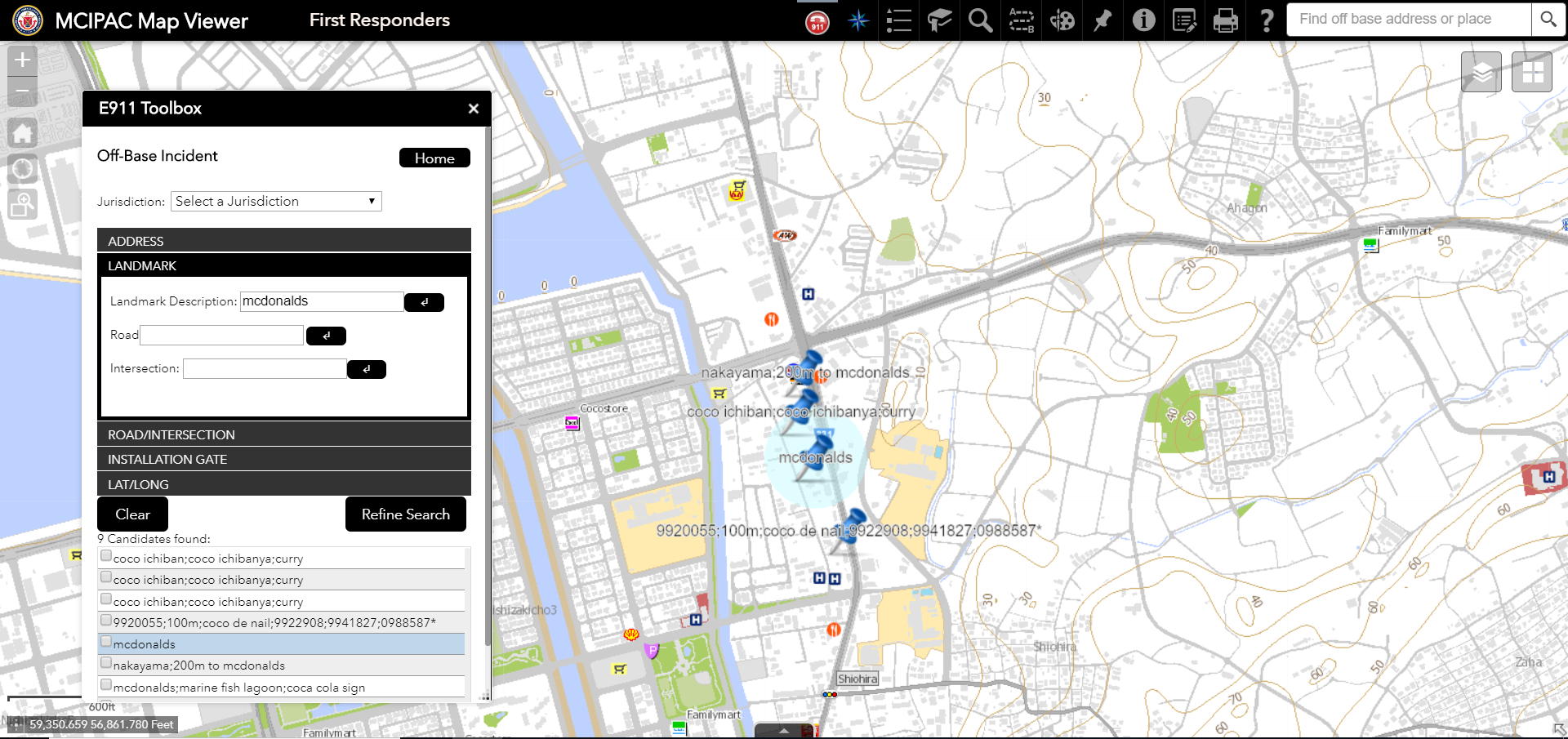
We currently provide the USMC and United States Air Force (USAF) with GEOFidelis and GeoBase support throughout the Pacific region including Japan, Korea, Hawaii, and Alaska; and our Army Common Installation Picture (CIP) geospatial data collection efforts include travel and support to over fifty (50) Army installation/sites across the U.S. with anticipated expansion to Europe and Asia. The result of our experience is an encyclopedic understanding of the political, regulatory, technical, and management challenges associated with DoD enterprise geospatial systems and installation management activities worldwide.
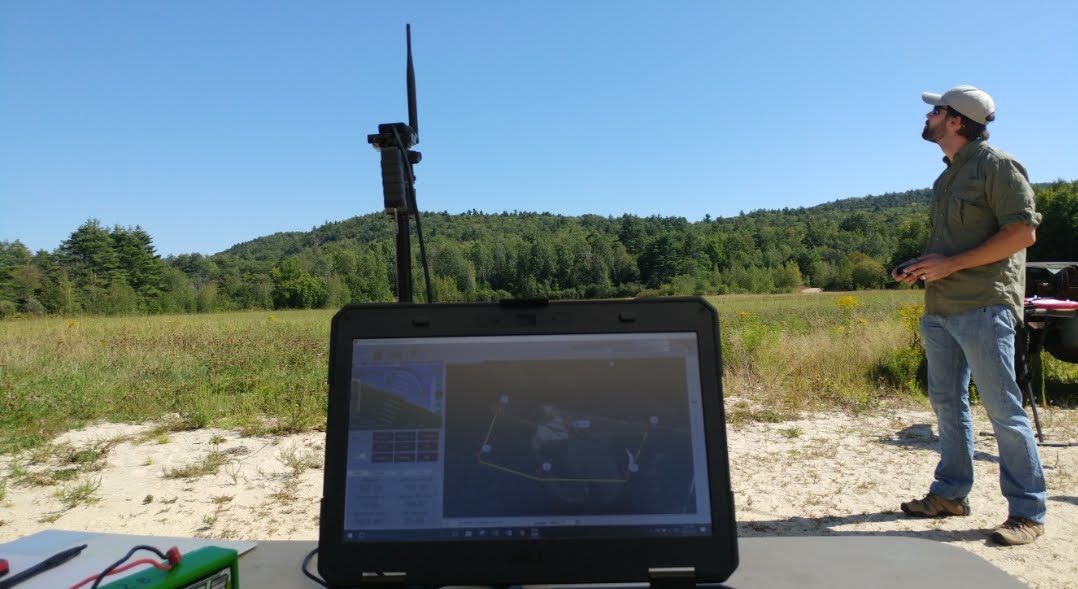
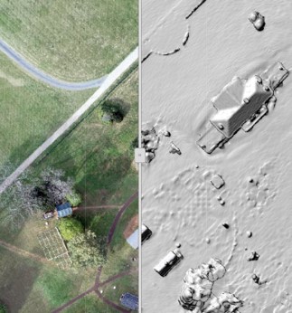
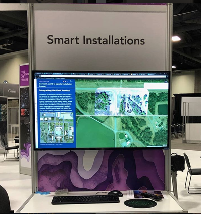
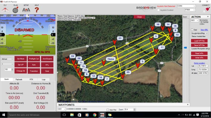
Small Unmanned Aircraft Systems (sUAS) have changed the characteristics of imagery workflows within organizations. Pairing GIS with sUAS allows us to deliver accurate, timely, and meaningful high-resolution data to organizations at a lower cost point when compared to traditional aircraft and satellite systems.
geocgi streamlines the delivery of sUAS and Enterprise GIS capabilities to organizations. We provide clients flexibility and agility with rapid mapping in the field, traditional orthomosaics, 3D webscenes, point clouds, and meshes. We monitor and record inspections of complex projects through sUAS and GIS technology. Resulting products are integrated into existing raster catalogs using Esri’s Mosaic Dataset and other enterprise geospatial solutions – providing end-users with near-immediate access to sUAS products.
geocgi’s team of geospatial professionals are Federal Aviation Administration (FAA) licensed through Part 107 as certified sUAS pilots and are experienced in:
geocgi is proficient in a variety of sUAS technologies and products, specializing in:
We use sUAS services to provide quick and comprehensive data collection for a multitude of functional use cases and mission requirements including:
geocgi is the most experienced small business providing Installation Geospatial Information & Services (IGI&S) support to the United States Marine Corps (USMC) and one of the most experienced providers of Geospatial Information Systems (GIS) related services to the Department of Defense (DoD) including the United States (US) Army and US Air Force. Our reputation for successful delivery is recognized DoD-wide and our founders, principals, and staff are highly regarded members of the GIS community. geocgi has provided GIS related services such as program management support, policy development, spatial data infrastructure (SDI), and strategic planning since 2006. We have, and continue to be, instrumental in evaluating emerging technologies and implementing Information Technology (IT) solutions – facilitating transformative and impactful changes in both mature and burgeoning GIS programs. The result of our experience is a thorough understanding of the political, regulatory, technical, and management challenges associated with enterprise geospatial systems and IT management activities.
Over the years we have supported the following clients:
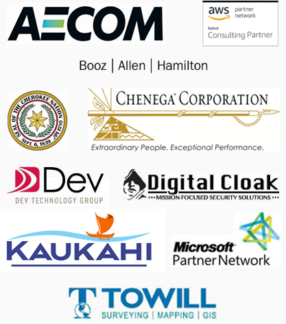
We proudly partner with:
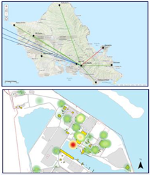
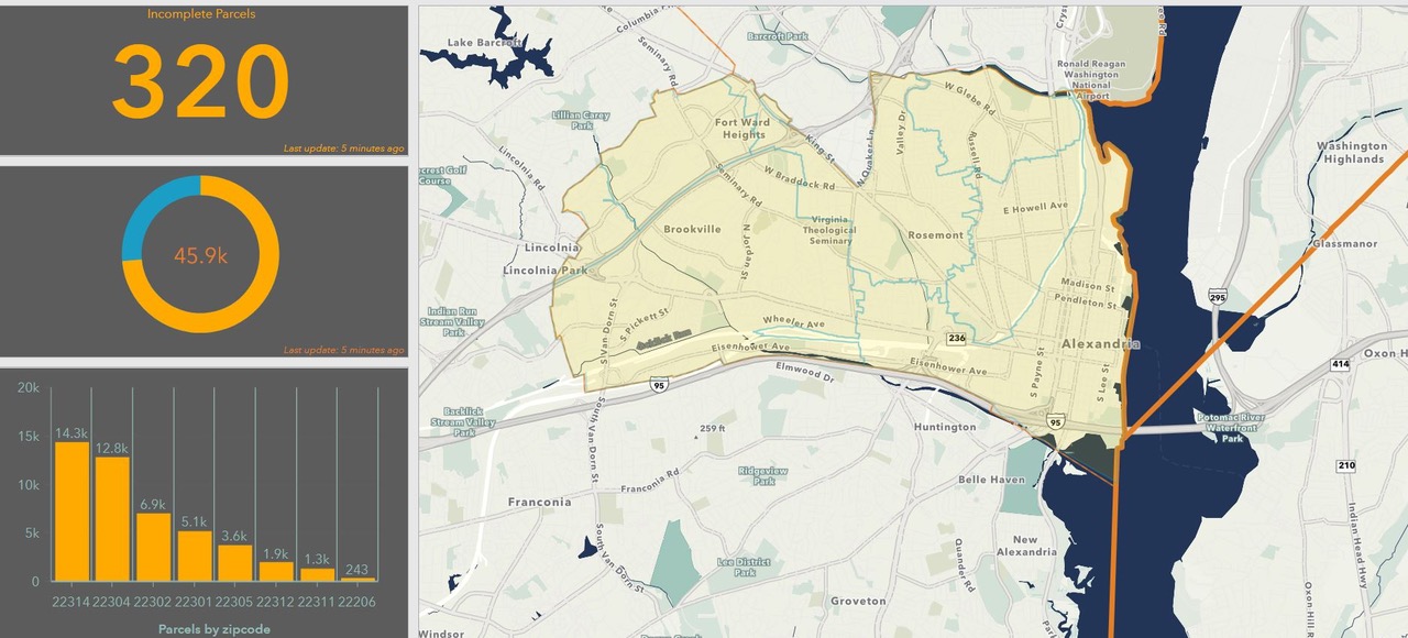
The geocgi Utility Asset Inventory Reconciliation (UAIR) team recently wrapped up the deliverables from their utilities data collection effort at Marine Corps Air Station (MCAS) Iwakuni, Japan. The project included performing field surveys to enhance the utilities network data for 9 different systems: Water, Wastewater, Stormwater, Electrical, Telecommunications, Thermal, Petroleum Oil Lubricants (POL), Natural Gas, and Compressed Gas.
UAIR is Marine Corps Installation Command’s (MCICOM) go-to utilities data collection vehicle. Along with our prime contractor, AECOM, geocgi is focusing on USMC installation utility geospatial data collection and standardization in the Pacific region. Our next target is Marine Corps Base Hawaii (MCBH) where the team will be collecting field data later this spring. On this trip, we will be focused on two systems, electrical and telecommunications.
The project has matured due to the lessons learned from Iwakuni. We follow a comprehensive approach for data collection, beginning with engaging installation subject matter experts, professional engineers, and local GIS personnel to determine the condition of existing utility geospatial data. We assess other data sources such as CAD and As-Builts, then work with local GIS staff to plan a focused data transformation and collection initiative, with the goal of integrating and creating decision-ready GIS data for the installation management community.
For more information on this project or our work with the USMC Installation Geospatial Information and Services (IGI&S) community, please reach out to our Director of Programs PG Katsourakis, pg.katsourakis@geocgi.com .

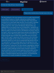
At geocgi, our commitment to providing innovative solutions for geospatial intelligence is unwavering. In line with this commitment, we are excited to introduce a groundbreaking integration between ArcGIS and ChatGPT, designed to elevate the user experience for our customers.
A Conversational Approach to Mapping
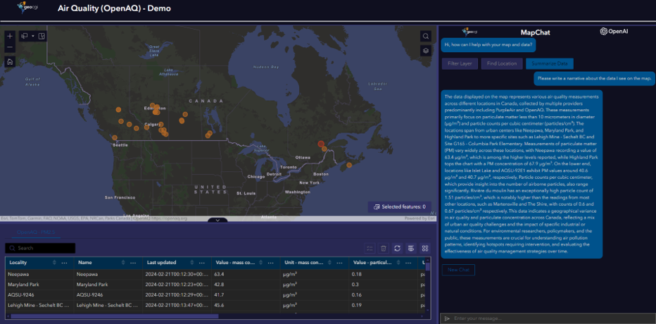
Imagine having a seamless conversation with your map and data. That's precisely what our custom chat widget for ArcGIS Experience Builder applications achieves. This innovative solution empowers users to engage in natural language conversations with ChatGPT, right from within their mapping applications. Whether it's asking questions about their data, applying complex filters, making selections, or controlling the map, users can accomplish it all effortlessly through the chat interface.
The Power of Integration
Our integration brings together the robust capabilities of ArcGIS with the conversational prowess of ChatGPT. This synergy enables users to interact with their geospatial data in a way that was once unimaginable. The fusion of mapping actions and natural language queries provides an intuitive and efficient means of exploring and understanding complex datasets.
Custom API for Seamless Communication
To facilitate this integration, we've developed a custom API that serves as the communication bridge between the client browser and the ChatGPT API. This not only ensures the security of our ChatGPT resources but also adds an extra layer of control and customization for our users.
Key Features of the Custom API:
Future Horizons: ArcGIS Knowledge Graphs
Our journey doesn't end here. We are actively working on expanding the capabilities of our integration to include interactions with ArcGIS Knowledge Graphs. This exciting development will open new possibilities for users to glean insights from their geospatial data through advanced conversational interactions.
Getting Started and Joining the Conversation
This integration promises a future where conversational exploration of maps and data becomes second nature.
Are you curious to learn more about the capabilities of our integration or eager to implement it in your applications? Reach out to us today! Our team is ready to provide additional information, answer your queries, and assist you in incorporating this cutting-edge solution into your geospatial workflows.
Your feedback and engagement are invaluable as we continue to push the boundaries of geospatial intelligence. Contact us to explore the possibilities and discover how the integration between ArcGIS and ChatGPT can transform your geospatial experience.
Stay tuned for updates, and let's shape the future of geospatial interaction together!
For more information, please contact info@geocgi.com

In the realm of emergency preparedness, every second counts. From natural disasters to unforeseen crises, having access to accurate location data is paramount for effective response and coordination. Geocgi engineers created a process utilizing the ArcGIS LocateXT tool that is transforming the landscape of Emergency Action Plan (EAP) management for the Department of State.
At the core of this groundbreaking approach lies the ArcGIS LocateXT tool, a powerful solution that employs regex (regular expressions) to swiftly extract location data embedded within PDF EAPs. This tool isn’t just a time-saver; it’s a game-changer that promises to revolutionize how emergency response data is collected, managed, and utilized. The journey begins with the recognition of a common challenge: the laborious task of manually digitizing location information from PDF documents. What once required hours of painstaking work can now be accomplished in mere minutes, thanks to our innovative use of Esri technology.
By harnessing the power of ArcGIS LocateXT, geocgi has unlocked a treasure trove of geospatial data hidden within these documents. Geographic coordinates, facility names, contact information – all seamlessly extracted with precision and accuracy, laying the foundation for more robust emergency preparedness efforts.

Image credit: Unsplash
But the impact doesn’t end there. This process represents more than just a time-saving innovation; it’s a catalyst for transformation. With location data extracted and structured, organizations can now move beyond manual data entry and embrace the power of automation and integration.
Central to this transformation is the migration of extracted data into a structured data store, typically housed in SQL databases. Here, the data becomes more than just a list of coordinates and names; it becomes a valuable resource for decision-making, analysis, and collaboration.
From this structured data store, we then deploy the distribution mechanism: GIS services. Built on top of the database, these services provide stakeholders with real-time access to live data through interactive web maps. In times of crisis, this accessibility is invaluable, empowering decision-makers with the insights they need to act swiftly and decisively.
But perhaps the most remarkable aspect of our approach is its simplicity. What once seemed like an insurmountable challenge – extracting location data from PDF documents – is now a straightforward process, thanks to the power of ArcGIS LocateXT.
As we look to the future, the implications of this work extend far beyond Emergency Action Plans. The process of location extraction pioneered here has the potential to revolutionize how we handle any unstructured data, regardless of its origin. From legal documents to research papers, the ability to extract location information opens doors swiftly and accurately to new possibilities in data management and analysis. In a world where information is key, this approach is a beacon of innovation, offering a pathway towards more efficient and effective utilization of data for the betterment of society.

Alexandria, Virginia – March 11, 2024. Geocgi received the Esri award for Integration at the 2024 Esri Partner Conference (EPC) held March 10–11, 2024 in Palm Springs, California. This award was presented to geocgi for the successful integration of ArcGIS with other IT systems to support customer business needs and workflows.
Geocgi is a woman-owned small business focused on providing geospatial and information technology services to large government organizations. With eighteen (18) years of Enterprise GIS Program support experience and Esri Partner Network (EPN) participation, geocgi is proud to announce we are now a Gold partner in the EPN. In addition to geocgi receiving the Esri Federal Small Business Specialty Partner of the Year award for 2024, this Integration award acknowledges geocgi’s efforts over the past year to integrate Esri technology with IT systems for large U.S. agencies and NATO programs, helping to ensure the safety of U.S. citizens and allies at home and abroad.
“Geocgi appreciates the recognition of past and current efforts to integrate Esri technology to improve business operations across our expanding client base. We look forward to continued collaboration with Esri in the delivery of innovative solutions within the GIS market.” said Andy Hanes, Vice President, geocgi.
Esri is the global leader in location intelligence with a network of over 2900 partners around the world. The award winners are organizations that have demonstrated innovative and creative ways to solve complex problems by using Esri’s ArcGIS software and those who have done exceptional work in advancing geographic information system (GIS) technology.
“Esri appreciates the strong partnership with geocgi and acknowledges their dedication to customer success with ArcGIS by awarding them this 2024 EPC award,” said Thomas Fair, Director, Esri Partner Network.
About Esri
Esri, the global market leader in geographic information system (GIS) software, location intelligence, and mapping, helps customers unlock the full potential of data to improve operational and business results. Founded in 1969 in Redlands, California, USA, Esri software is deployed in hundreds of thousands of organizations globally, including Fortune 500 companies, government agencies, nonprofit institutions, and universities. Esri has regional offices, international distributors, and partners providing local support in over 100 countries on six continents. With its pioneering commitment to geospatial technology and analytics, Esri engineers the most innovative solutions that leverage a geographic approach to solving some of the world’s most complex problems by placing them in the crucial context of location. Visit us at esri.com.
Geocgi is a woman-owned small business technology and consulting firm supporting nation-wide and world-wide geospatial programs. We specialize in the implementation and integration of GIS, enterprise GIS program management, geospatial data management and analysis, drone imagery collection, and cloud technologies.
Media may contact info@geocgi.com.

Geocgi was recently awarded a five year, prime contract to provide specialized technical staffing and operational support to the United States Agency for International Development (USAID) GeoCenter. These services support all aspects of USAID's international development programming, covering each of the Agency’s major sectors and geographies. Using geographic, economic, and demographic data, the GeoCenter generates geospatial insights through custom analyses and maps for USAID missions in the field and offices based in Washington, DC. These efforts inform every phase of USAID’s Program Cycle, from strategic planning to activity design, implementation, monitoring, and evaluation. The geocgi team is excited to support the USAID mission.

Alexandria, Virginia - February 13, 2024. Geocgi received the Esri Federal Small Business Specialty Partner of the Year award at the Esri Federal GIS Conference held February 13-14, 2024, in Washington, DC. Geocgi was one of two Esri partners in the Esri Partner Network (EPN) recognized at the conference for excellence in their work with Esri in the US Federal Government market.
Geocgi is a woman-owned small business with eighteen (18) years of Enterprise GIS Program support experience and Esri Partner Network participation. Now a Gold EPN Partner, geocgi has expanded their client base beyond the US Department of Defense to include the US Postal Service, US Department of Agriculture, US Department of State, US Geological Survey, NATO, and several large commercial businesses – all of which employ the Esri suite of products. Our work over the past year has included close coordination with Esri on many business opportunities, both nationally and internationally. The Esri Federal Small Business Specialty (FSBS) Partner of the Year award is an overall award for achievement across all FSBS program areas, including program participation, marketing, customer success, and technology alignment.
Esri is the global leader in location intelligence with a network of 2900 EPN partners around the world. The award winners have demonstrated exceptional ways to deliver solutions to the US Federal Government with Esri’s ArcGIS software to advance the use of geographic information system (GIS) technology by these organizations.
“Esri congratulates geocgi on their 2024 Federal Small Business Specialty Partner of the Year award in recognition of their work leveraging ArcGIS software,” said Thomas Fair, Director, Esri Partner Network. “We are proud to partner with geocgi to foster the use of Esri technology in support of our mutual US Federal Government customers.”
“Geocgi appreciates the recognition of past and current efforts to leverage GIS capabilities and Esri technologies to improve business operations across our expanding client base. We look forward to continued collaboration with Esri in the delivery of innovative solutions within the GIS market.” said Andy Hanes, Vice President, geocgi.
About Esri
Esri, the global market leader in geographic information system (GIS) software, location intelligence, and mapping, helps customers unlock the full potential of data to improve operational and business results. Founded in 1969 in Redlands, California, USA, Esri software is deployed in hundreds of thousands of organizations globally, including Fortune 500 companies, government agencies, nonprofit institutions, and universities. Esri has regional offices, international distributors, and partners providing local support in over 100 countries on six continents. With its pioneering commitment to geospatial technology and analytics, Esri engineers the most innovative solutions that leverage a geographic approach to solving some of the world’s most complex problems by placing them in the crucial context of location. Visit us at esri.com.
About geocgi
Geocgi is a woman-owned small business technology and consulting firm supporting nation-wide and world-wide geospatial programs. We specialize in the implementation and integration of GIS, enterprise GIS program management, geospatial data management and analysis, drone imagery collection, and cloud technologies.
Media may contact info@geocgi.com
Geocgi was recently awarded a contract to help modernize and enhance the U.S. Coast Guard’s (USCG) Waterways Analysis and Management System (WAMS). The WAMS support contract was awarded under the Department of Homeland Security (DHS) Geospatial Technology Support Services (GTSS) 2.0 Blanket Purchase Agreement (BPA), of which geocgi is a co-prime contract holder under a General Services Administration (GSA) Contract Teaming Agreement (CTA). As a coordinated effort between DHS Science and Technology (S&T) Acquisition Division and USCG Office of Navigation Systems (CG-NAV), WAMS will leverage current technologies and expertise to develop better ways to conduct waterway health assessments, analyze the condition of ports and waterways after disasters, and develop risk-based mitigation and recovery strategies. The scope of this contract includes completing coding of WAMS modules 3 and 4 (Waterway Analysis and Trends and Waterway Design), integration support with the United States Aids to Navigation Information Management System (USAIMS) – an interface application to the Aids to Navigation Information System (ATONIS), and WAMS user training and technical support.
The WAMS contract was issued by the DHS Science and Technology (S&T) Acquisition Division. To learn more about this project, or our other Coast Guard work, reach out to Nathan Russell, nathan.k.russell@geocgi.com.
Photo by Ray Harrington on Unsplash


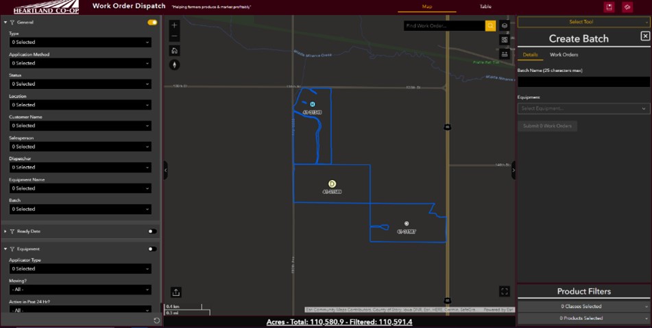 Heartland Co-op approached us with the requirement to modernize the dispatch application just before peak season was about to begin. After understanding the requirement and gathering necessary functionality, we began an agile development strategy to stay on schedule. Weekly sprints allowed stakeholders to keep a close watch on development and gave them the ability to quickly make on-the-fly adjustments. The first stage of development included creating a JavaScript module for communicating over HTTP to the custom API, enabling the application to send and receive data to the work order database of record. Next, we created the various widgets targeting custom required features. These widgets include batching CRUD tools, product filtering, and acreage summaries. Geocgi also created a routing function to easily visualize the sequence of work orders within batches on the map. Alongside this development, we created the Feature Service to be consumed by the web map and related application. This service included a point layer for work orders, field boundaries, current equipment locations, and other relevant layers. Once this service was published and a web map was created, developers were able to start configuring the application within ArcGIS Experience Builder. Within the new app, various configurable widgets were added to compliment the custom widgets that were in development. Upon completion of the configurable app and the custom widgets, a full testing suite was set up to allow multiple testers from Heartland Co-op and geocgi to test all functionality and identify bugs. During this testing phase, we generated ideas for further enhancements to improve the application. After addressing all bugs and enhancements, integrators deployed the application to the production system, dispatchers were trained, and existing workflows migrated to the new production application.
Heartland Co-op uses this application throughout their peak fertilizing seasons and have reported no issues with functionality. In addition to this dispatching application our Solution Engineers developed a historical work order viewer/analyzer application which uses some of the same custom widgets but also includes other charts and analytics for reporting. The Geocgi and Heartland Co-op partnership is now looking to the future planning enhancements to this application and development of other web-GIS applications. For more information on this project, please contact our Solutions Manager, Jesse Parker, jesse.w.parker@geocgi.com.
Header Photo by Taylor Siebert on Unsplash
Heartland Co-op approached us with the requirement to modernize the dispatch application just before peak season was about to begin. After understanding the requirement and gathering necessary functionality, we began an agile development strategy to stay on schedule. Weekly sprints allowed stakeholders to keep a close watch on development and gave them the ability to quickly make on-the-fly adjustments. The first stage of development included creating a JavaScript module for communicating over HTTP to the custom API, enabling the application to send and receive data to the work order database of record. Next, we created the various widgets targeting custom required features. These widgets include batching CRUD tools, product filtering, and acreage summaries. Geocgi also created a routing function to easily visualize the sequence of work orders within batches on the map. Alongside this development, we created the Feature Service to be consumed by the web map and related application. This service included a point layer for work orders, field boundaries, current equipment locations, and other relevant layers. Once this service was published and a web map was created, developers were able to start configuring the application within ArcGIS Experience Builder. Within the new app, various configurable widgets were added to compliment the custom widgets that were in development. Upon completion of the configurable app and the custom widgets, a full testing suite was set up to allow multiple testers from Heartland Co-op and geocgi to test all functionality and identify bugs. During this testing phase, we generated ideas for further enhancements to improve the application. After addressing all bugs and enhancements, integrators deployed the application to the production system, dispatchers were trained, and existing workflows migrated to the new production application.
Heartland Co-op uses this application throughout their peak fertilizing seasons and have reported no issues with functionality. In addition to this dispatching application our Solution Engineers developed a historical work order viewer/analyzer application which uses some of the same custom widgets but also includes other charts and analytics for reporting. The Geocgi and Heartland Co-op partnership is now looking to the future planning enhancements to this application and development of other web-GIS applications. For more information on this project, please contact our Solutions Manager, Jesse Parker, jesse.w.parker@geocgi.com.
Header Photo by Taylor Siebert on Unsplash In addition to directly awarded contracts, geocgi maintains a number of contracting vehicles and partner/teaming relationships for fast, flexible access to the full range of our technology offerings.
Contract vehicles:


Socio-Economic Status
By 2025 cloud-native platforms will serve as the foundation for more than 95% of new digital workloads. Access to mission critical data will no longer be bound by traditional on-premises datacenters as applications, websites, and systems become more reliant on cloud infrastructure. Cloud infrastructure is highly configurable to meet the organization's exact needs, scale, and business capabilities. Traditional investments in IT hardware and on-premises data centers require constant maintenance, facility space, and detailed disaster recovery and failover procedures. With cloud infrastructure, the overhead to manage your system is a fraction of the effort and cost while saving your organization space and providing peace of mind that your data and systems are secure and redundant.
Geocgi can assist your organization build and secure a new cloud environment or with a modernization and migration transition, leveraging a scalable infrastructure to pay only for what you need. Our certified engineers have experience with hybrid and full cloud implementations, including:
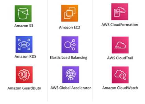
Geocgi is an ArcGIS Cloud Specialty preferred Esri partner with ArcGIS Enterprise in cloud environments. We are an AWS Select Consulting Partner and can meet client objectives with AWS, Microsoft Azure, and hybrid-cloud environments. We staff AWS Cloud Practitioners, AWS Solutions Architects, AWS Developers, and Esri Enterprise Administration Associates.

We’re a team with diverse interests and unique personalities that shares a love of GIS and a passion for entrepreneurship. And while we’re made up of more than our management team, these are the guys and gals that get paid to take your calls, so feel free to reach out.
President
Questions the necessity of any meeting that isn’t a “lunch meeting”.
Vice President/OCONUS Programs Lead
Saving the world. . . one rescue animal at a time.
Director of Operations/Federal Programs Lead
Makes maps for weekend bar crawls.
Director of Programs/Marine Corps Programs Lead
Photios George Katsourakis. DNA kit not required.
Director of Administration and Human Resources
More interested in what your dog did over the weekend.
Director of IT/IT Programs Lead
Fountain of useless knowledge.
Director of Business Development
Not sure if Burning Man is right for you? Ask Jason.
Solutions Manager
I’m not oblivious, I just don’t care
Program Manager/Navy and Environmental Programs Lead
Big picture problem identifier. . .looking for volunteer solution identifiers
sUAS Lead
Knows the exact height at which grass becomes a terrorist threat.
Program and Operations Manager
Operations Analyst
Will argue that a workday nap is a strategic recharge
Our goal is to bring talented people together and create something that makes us all proud. We are friends and we are family. We look out for each other and our company culture and benefits are designed to reflect that.
We want you happy and healthy - we cover 100% of employee medical, vision, and dental plan premiums. We also think it's never too early or too late to help you reach your long term financial goals, so we contribute 3% on top of your salary into your 401k - regardless of your contribution.
We want you to be motivated and engaged so we offer flexible hours along with opportunities to work remotely. Take time off when you need it and then come back refreshed and ready to crush it with your team.
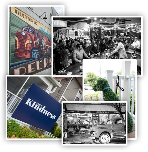
We are situated in one of the coolest, family friendly neighborhoods in the DC Metro area. Our office is accessible and walkable to public transportation, restaurants, and parks.
We don't take ourselves too seriously and our office space reflects that. It is unique, comfortable, and a relaxing environment. Cook lunch in our full kitchen or on the grill out back. Bring your dog. Kick off your shoes - we've got slippers!
We think it's important to never stop learning and growing. Take advantage of our tuition and continuing education reimbursements. Step outside of your box and take on a research and development project. Participate in our mentorship program. Attend a conference. Go and do!
When we need a break, we throw darts or put together a spontaneous bbq. We have regular team lunches and happy hours too. In short, we love hanging out together and having a good time.