we are
Collaborators / Strategists / Globetrotters / Competitive / Loyal / Accountable / Equals / Pet-Friendly / A Somewhat Motley Crew / Honored to Do What We Do / Moving Forward (So Keep Up)
We pride ourselves on not losing our focus. We started out and remain GIS experts (or geeks. . . depending on your perspective). Since 2006, we’ve evolved into a world-class and world-wide service provider of multiple disciplines. We are a talented, hardworking group that share values and characteristics that drive client, professional, and personal success.
Collaborators / Strategists / Globetrotters / Competitive / Loyal / Accountable / Equals / Pet-Friendly / A Somewhat Motley Crew / Honored to Do What We Do / Moving Forward (So Keep Up)
Your Average Joes / Generalists / Greedy / Afraid to Speak Up / Hierarchical / Wizards / Mean / Entitled / Going to Waste Your Time / Party Poopers
For over a decade it has been an honor to serve the men and women who risk it all. The clients we serve have a mission that exceeds all others. We aid them through hard work, strategic execution, and a genuine concern for their business and their resources. We are proud to continually expand our service offerings while remaining true to our passion.
Geocgi has established a distinguished reputation for excellence in deploying Esri’s ArcGIS suite of software. As an Esri Gold Business Partner, we consistently exceed customer requirements and expectations by delivering high-quality Esri system design, integration, and deployment. Our expertise spans enterprise and web-GIS solutions, with a strong focus on ArcGIS Enterprise (Portal and Server) across both on-premises and cloud-based infrastructures.
Our team has comprehensive knowledge of the entire suite of Esri enterprise products, enabling us to create tailored solutions for a wide range of organizational needs. To further enhance the capabilities of ArcGIS Enterprise, we specialize in extending its out-of-the-box functionality by leveraging powerful tools like Python and JavaScript. This approach allows us to deliver customized solutions that add significant value to our customers’ GIS experiences.
We employ established geospatial professionals with validated skills and experience. Our staff have been vetted as geospatial technology experts with Esri through the following certifications:
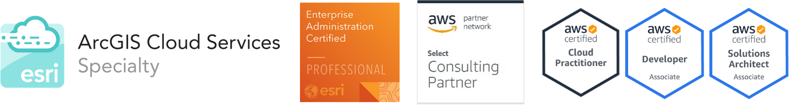
Our expertise is supported by Esri accredited specialties that include Federal Small Business, ArcGIS Indoors, and ArcGIS Cloud Services. In 2024, geocgi was named the Esri Federal Small Business Specialty Partner of the Year and received the Esri Integration Award and the Esri Partner Conference.

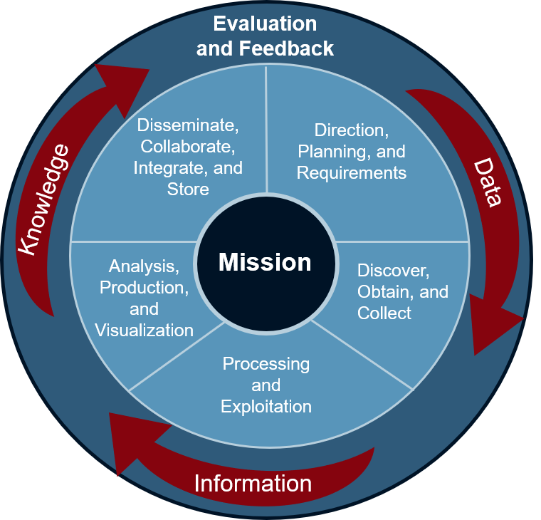
Geospatial information is increasingly being used for data driven decision making, resulting in a reliance on geospatial programs to store, manage, and disseminate relevant and accurate geospatial data to stakeholders. Effective geospatial program management facilitates a geospatially enabled environment.
Our principally GIS-focused service offerings ensure that we remain adept in the latest software and industry trends, resulting in innovative solutions for long term program success and viability.
geocgi supports the United States Marine Corps (USMC), U.S. Air Force, and U.S. Army GIS programs at the Headquarter, Region, and Installation levels – both Continental United States (CONUS) and Outside the Continental United States (OCONUS) – leading to proficiency in all aspects of coordination and management of an enterprise geospatial program.

geocgi personnel specialize in the establishment of strategic plans; the implementation of policies, procedures, and communication strategies; and the achievement of mission objectives. Related geospatial program management experience includes:
Since 2006, geocgi has supported USMC Installation Geospatial Information & Services (IGI&S), GEOFidelis Program, with policy and strategic support to ensure that USMC installation geospatial data is complete, accurate, protected, current, and available for USMC and Department of Defense wide utilization. We actively represent USMC interests in the IGI&S Governance Group (previously known as the Defense Installations Spatial Data Infrastructure Group) as well as supported program initiatives mentioned below:
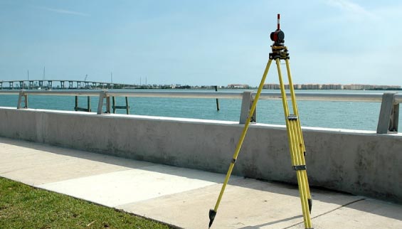
Clients use spatial data to drive many of their important business decisions. Spatial data supports visualization and analysis to study relationships, observe patterns, and provide insight to organizations. We leverage unique domain knowledge with data sources, techniques, and workflows involved in data collection including but not limited to:
With organizational “buy in” and high accuracy, geospatial data can significantly improve decision making. Since 2006 geocgi has engaged with Department of Defense (DoD) SME’s – establishing credibility, expanding knowledge, and cultivating relationships at all levels. We are fluent in the geospatial data standards that translate functional requirements into authoritative, useful data for products, services, and analyses.
geocgi provides geospatial data services and related support to the United States Army through the Office of the Assistant Chief of Staff for Installation Management (OACSIM) across the continental United States.We staff the United States Marine Corps (USMC) and the United States Air Force (USAF) installations, both for the Continental United States (CONUS) and Outside the Continental United States (OCONUS), including: Joint Base Elmendorf-Richardson, Eielson Air Force Base, Marine Corps Base Camp Butler, and Marine Corps Air Station Iwakuni. Our analysts are geospatial data creators, adjudicators, and implementers at the installation and enterprise levels.
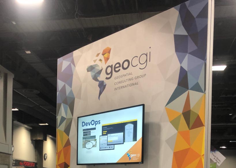
Whether you call it “DevOps” or “DevSecOps” the tight integration of security protocols within the application development lifecycle streamlines and expedites the delivery of applications and services to clients. As applicable, we apply the technology across a wide range of projects.
geocgi develops and maintains Arlington National Cemetery (ANC) & Army National Military Cemeteries (ANMC) Website Development Operations & Maintenance (O&M) web presence, including custom web applications using the ASP.NET stack and DNN Content Management System (CMS). We perform rigorous requirements gathering to ensure systems are hardened and STIG compliant throughout the development and release cycles. Custom applications include: Headstone Designer, Events and Ceremonies, Multi-Media Blogs and Responsive Designs.
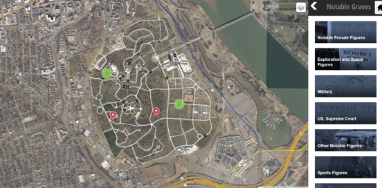
ANC Explorer is the cemeteries interactive map and grave finder. Developing in HTML 5 and AngularJS, while incorporating technology from Leaflet, MapBox, and ESRI, we provided a seamless and secure mapping and visualization experience for visitors on the web, mobile, and kiosk platforms.
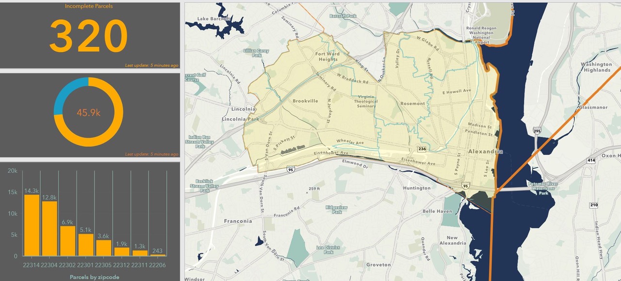
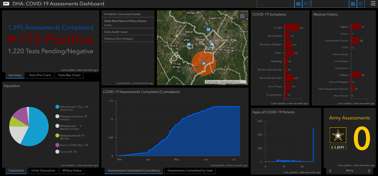
geocgi stood up a cluster of secure cloud-based Esri application servers to quickly and securely analyze drone imagery collected for the Installation Geospatial Information & Services (IGI&S) Common Installation Picture (CIP) Data Collection and Standardization for Headquarters, Department of the Army (HQDA) effort that we have headed for nearly three years.
geocgi built a secure cloud-based application development environment, utilizing IaaS technology for Marine Corps Installations Pacific (MCIPAC) IGI&S application development efforts. Through this environment, the client and our developers access, build, test and push hardened STIG compliant applications all siloed in a safe environment.
Utilizing ASP.NET framework and an MVC (model-view-controller) architecture, geocgi implemented creative and secure solutions for data visualization inside desktop and web-based applications within the USMC Critical Asset Management System (CAMS) for the USMC Mission Assurance Development Lab (MADL). Additionally, using GEOFidelis assets, geocgi integrated a GIS module into the system using Esri software developers kit (SDK).
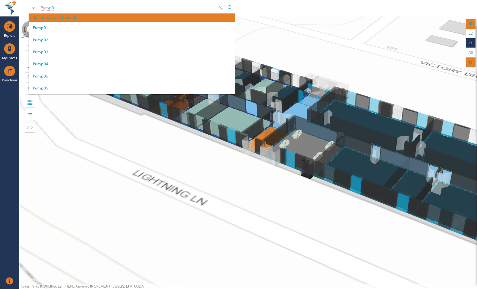
An enterprise GIS provides broad access to geospatial data and applications throughout the organization. The combination of geospatial enterprise technology and Web GIS provides applications and tools to end users for analysis and visualization. Organizations can use dynamic geospatial data within custom enterprise solutions to better collaborate, communicate, and solve their unique problems. Web GIS platforms are ideal decision-making tools within an organization because they enable employees, stakeholders and subject matter experts. Whether in the office or out in the field enterprise technology allows your organization to access, edit, and share relevant and timely data, maps, applications, and workflows.
Geospatial Enterprise and Web GIS enable organizations to provide broad access to authoritative GIS data. geocgi is committed to developing GIS professionals that exceed the requirements of implementing this evolving technology; and focus on innovation in GIS design and incorporating related technologies.
Enterprise: ArcGIS Enterprise (ArcGIS Server + Server Extensions, Portal for ArcGIS, ArcGIS Data Store, ArcGIS Web Adaptor)
Web GIS: Portal for ArcGIS and ArcGIS Online (Web AppBuilder, Story Maps, Mobile GIS, 3D Web Scenes)
Geospatial Databases: MS SQL Server, Oracle, PostGRESQL, MySQL
Geospatial Development: JavaScript, Java, Leaflet, .Net, MVC, AngularJS, iOS and Android, and a long list of SDKs and APIs.

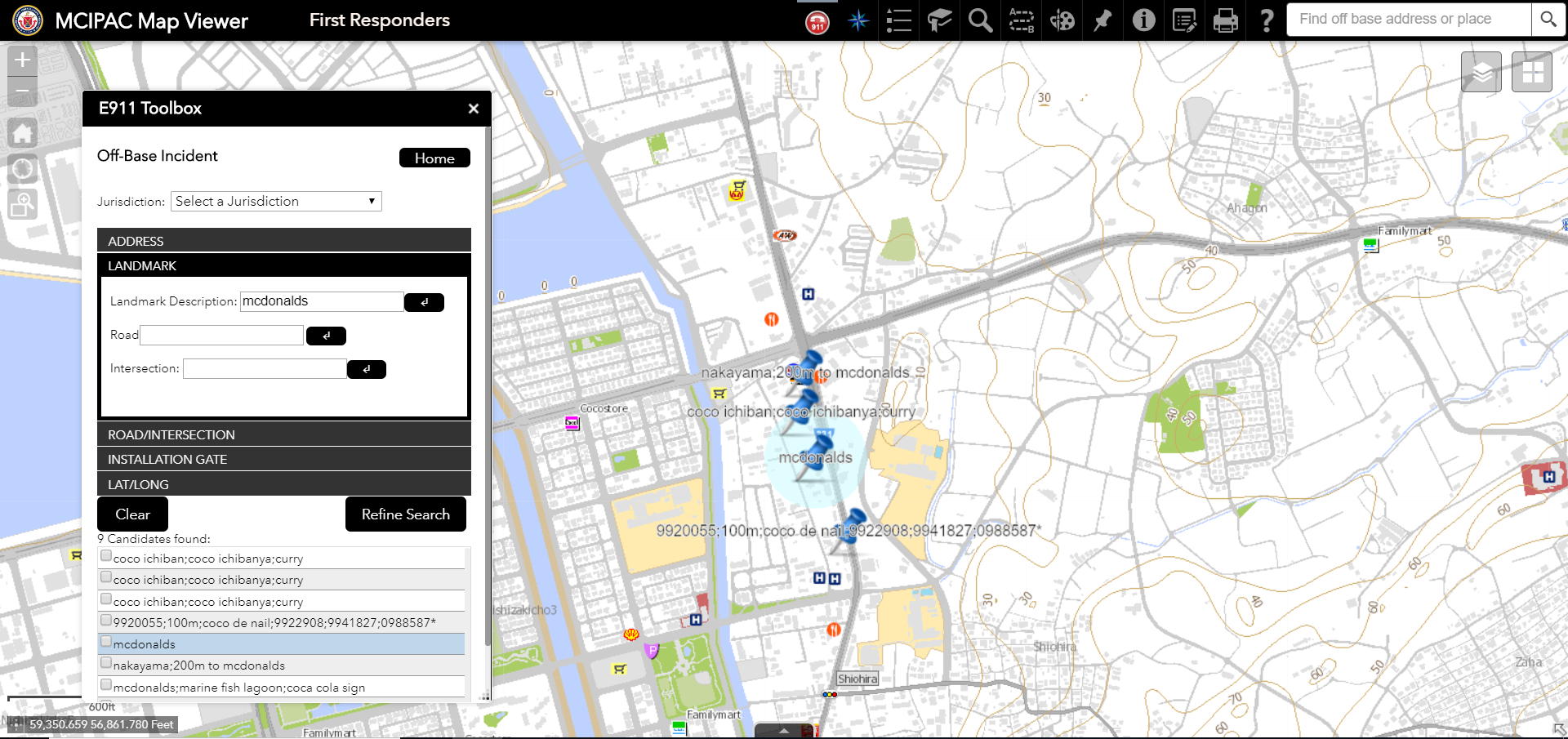
geocgi has designed, developed and implemented ArcGIS Enterprise utilizing industry standards and best practices. The system is a multi-tiered and highly available enterprise, providing geospatial data services for the Marine Corps Installations Pacific (MCIPAC) region serving data for six installations across Japan, Korea, and Hawaii. The MCIPAC Enterprise Architecture uses a three-tier application approach encompassing the production, presentation and application tiers.
Production Tier is a series of virtualized environments spread across three physical host machines providing the ability to store, produce and serve data across the entire enterprise for a large user community. Data is made available for both the application and presentation tiers through MS SQL Server and ArcGIS Datastore.
Application Tier utilizes Remote Desktop Services (RDS) to provide ArcGIS Desktop to MCIPAC analysts and grants the ability to maintain the authoritative geodatabases as well as produce cartographic products on demand.
Presentation Tier includes both ArcGIS Server and ArcGIS Portal allowing geospatial information from within the enterprise and out to be discoverable, shareable and visualized through web applications and maps.
geocgi is one of the most experienced small businesses currently providing Department of Defense (DoD) Installation Geospatial Information & Services (IGI&S) support. Since 2006, we have provided on-site functional and technical GIS programmatic support to the United States Marine Corps (USMC), U.S. Army, and U.S. Air Force. On-site support has been provided at the Headquarter, Region, and Installation levels – both the Continental United States (CONUS) and Outside the Continental United States (OCONUS).


We currently provide the USMC and United States Air Force (USAF) with GEOFidelis and GeoBase support throughout the Pacific region including Japan, Korea, Hawaii, and Alaska; and our Army Common Installation Picture (CIP) geospatial data collection efforts include travel and support to over fifty (50) Army installation/sites across the U.S. with anticipated expansion to Europe and Asia. The result of our experience is an encyclopedic understanding of the political, regulatory, technical, and management challenges associated with DoD enterprise geospatial systems and installation management activities worldwide.
geocgi’s Owners, Executives, and Program Management Team possess decades of GIS programmatic knowledge establishing them as experts in identifying the right qualifications and skills to augment client resources. Our Corporate Management staff have operational, human resource, and security experience in direct support of DoD GIS programs. Staff can effectively screen personnel who may or may not be suited for the client side environment. One of our biggest lessons learned in staffing is that it is best to take the time to find the right person for the long term than to settle on the wrong person short term.
geocgi’s success in recruiting and retaining quality GIS personnel is rooted in our company’s principal GIS technology focus; our small business size and leadership accessibility at all levels of our organization; the GIS skills and backgrounds of our owners/executives; our aggressiveness in actively researching and continually improving employee benefits that will attract and retain top talent in the GIS/IT field(s). We also regularly gauge employee satisfaction and are committed to offering employee recognition and a challenging work environment.
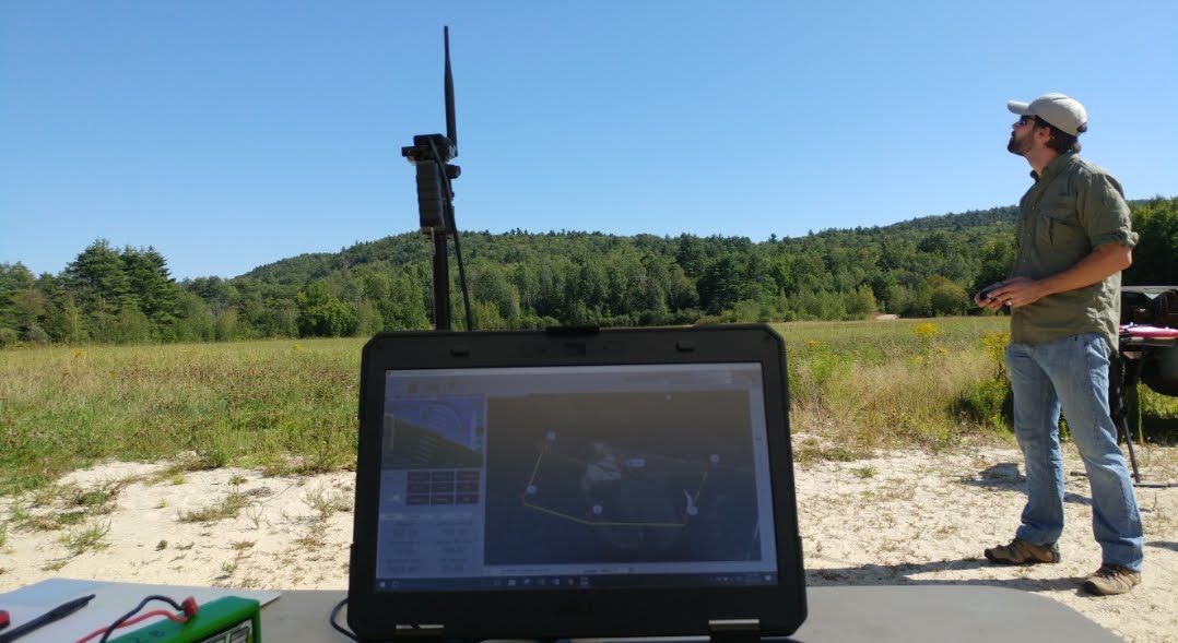
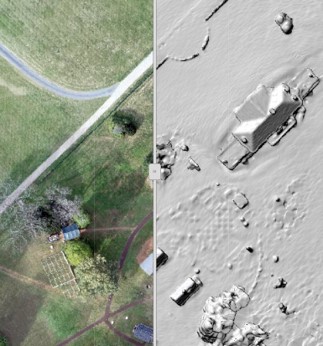
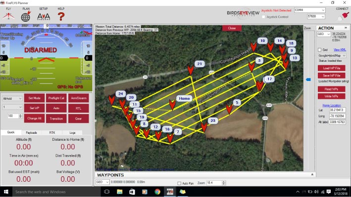
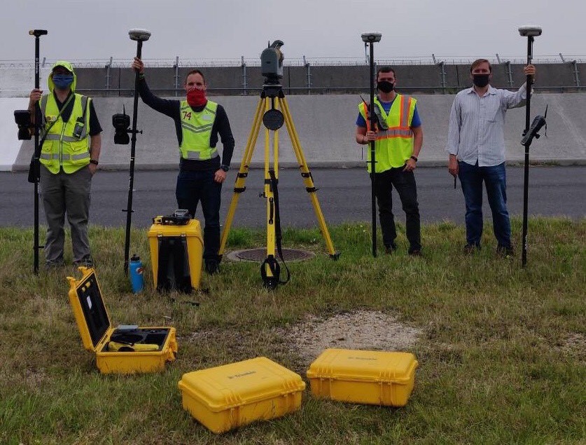
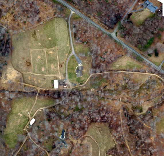
Small Unmanned Aircraft Systems (sUAS) have changed the characteristics of imagery workflows within organizations. Pairing GIS with sUAS allows us to deliver accurate, timely, and meaningful high-resolution data to organizations at a lower cost point when compared to traditional aircraft and satellite systems.
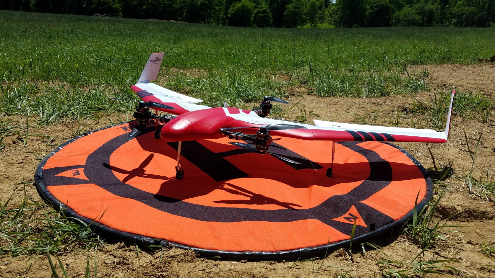
geocgi streamlines the delivery of sUAS and Enterprise GIS capabilities to organizations. We provide clients flexibility and agility with rapid mapping in the field, traditional orthomosaics, 3D webscenes, point clouds, and meshes. We monitor and record inspections of complex projects through sUAS and GIS technology. Resulting products are integrated into existing raster catalogs using Esri’s Mosaic Dataset and other enterprise geospatial solutions – providing end-users with near-immediate access to sUAS products.
geocgi’s team of geospatial professionals are Federal Aviation Administration (FAA) licensed through Part 107 as certified sUAS pilots and are experienced in:
geocgi is proficient in a variety of sUAS technologies and products, specializing in:
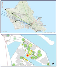
We use sUAS services to provide quick and comprehensive data collection for a multitude of functional use cases and mission requirements including:
Through the Office of the Assistant Chief of Staff for Installation Management (OACSIM), geocgi has performed sUAS data collection on behalf of the US Army at multiple Army installations including; Letterkenny Army Depot, McAlester Army Ammunition Plant, Watervliet Army Arsenal, and Picatinny Arsenal. Additionally, we performed a feasibility study on behalf of Marine Corps Installations Pacific (MCIPAC) for sUAS services to the region. Commercially, we have performed sUAS data collection for a variety of sites including James Madison’s Montpelier, the Pavilion at Rancho Mission Viejo, Mojave Desert Land Trust, GHA Racing, Lorton Arts Foundation, and PA Bowen Farmstead.
geocgi is the most experienced small business providing Installation Geospatial Information & Services (IGI&S) support to the United States Marine Corps (USMC) and one of the most experienced providers of Geospatial Information Systems (GIS) related services to the Department of Defense (DoD) including the United States (US) Army and US Air Force. Our reputation for successful delivery is recognized DoD-wide and our founders, principals, and staff are highly regarded members of the GIS community. geocgi has provided GIS related services such as program management support, policy development, spatial data infrastructure (SDI), and strategic planning since 2006. We have, and continue to be, instrumental in evaluating emerging technologies and implementing Information Technology (IT) solutions – facilitating transformative and impactful changes in both mature and burgeoning GIS programs. The result of our experience is a thorough understanding of the political, regulatory, technical, and management challenges associated with enterprise geospatial systems and IT management activities.


Over the years we have supported the following clients:
We proudly partner with:

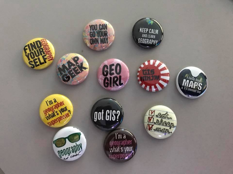
Happy GIS Day! While we celebrate our love of GIS and maps every day, we love that each GIS day we get to share that passion with others. Our t...
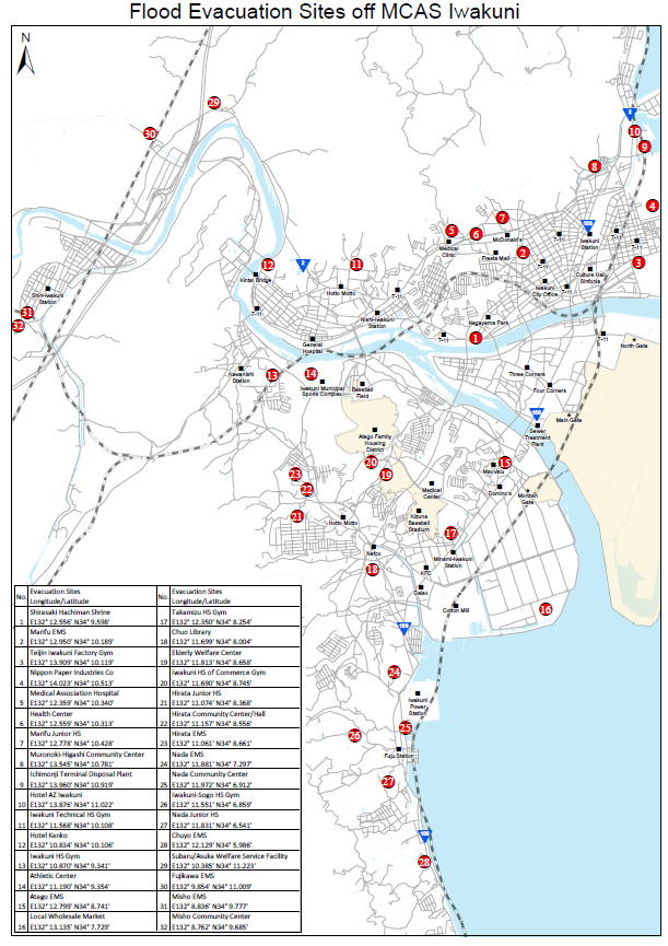
Evacuation sites have been identifie...
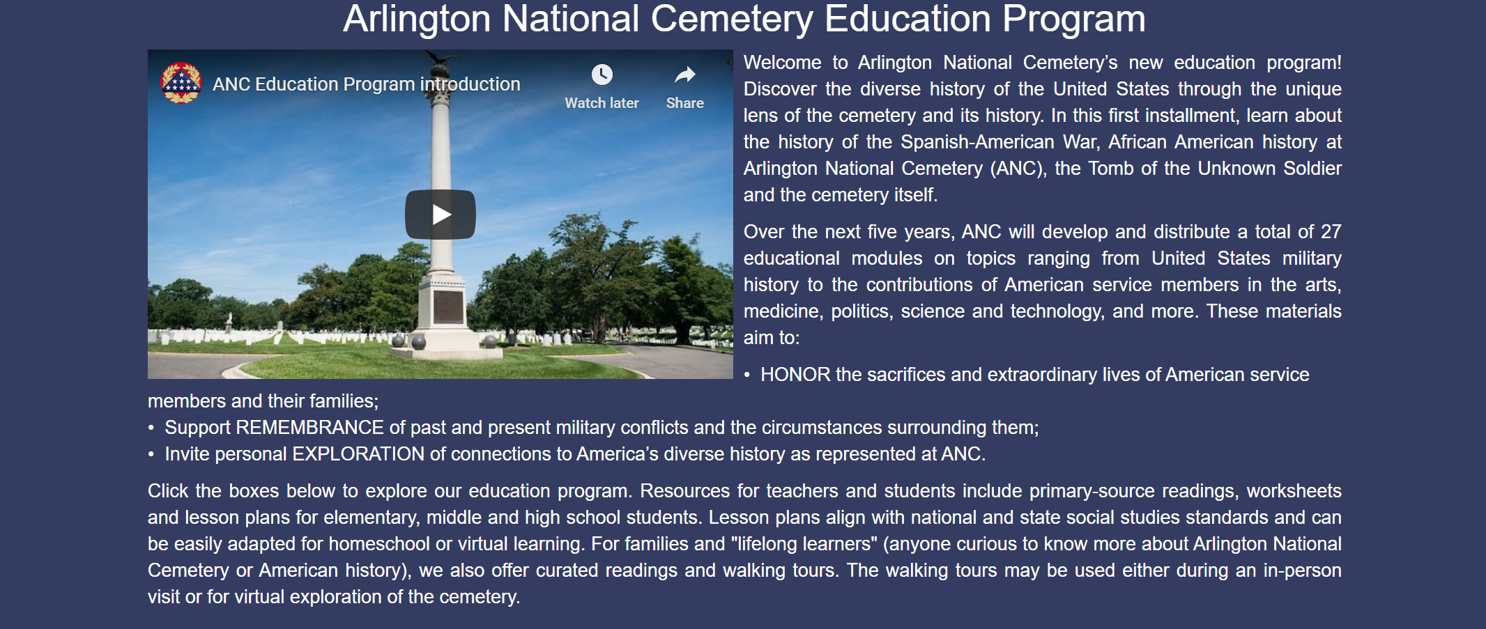
Arlington National Cemetery (ANC) recently launched an online education program that allows the public to learn the diverse history of the United States through the lens of ANC. In this first phase...

Dedicated on May 15, 1920, the Memorial Amphitheater at Arlington National Cemetery is a stunning visual feature of the cemetery. Today marks the 100th anniversary of the cent...

We recently completed a 3+ years effort supporting the HQDA DCS, G-9 contract for Common Installation Picture (CIP) data collection and standardization. Please read more about...

In addition to directly awarded contracts, geocgi maintains a number of contracting vehicles and partner/teaming relationships for fast, flexible access to the full range of our technology offerings.
Contract vehicles:


Socio-Economic Status


By 2025 cloud-native platforms will serve as the foundation for more than 95% of new digital workloads. Access to mission critical data will no longer be bound by traditional on-premises datacenters as applications, websites, and systems become more reliant on cloud infrastructure. Cloud infrastructure is highly configurable to meet the organization's exact needs, scale, and business capabilities. Traditional investments in IT hardware and on-premises data centers require constant maintenance, facility space, and detailed disaster recovery and failover procedures. With cloud infrastructure, the overhead to manage your system is a fraction of the effort and cost while saving your organization space and providing peace of mind that your data and systems are secure and redundant.
Geocgi can assist your organization build and secure a new cloud environment or with a modernization and migration transition, leveraging a scalable infrastructure to pay only for what you need. Our certified engineers have experience with hybrid and full cloud implementations, including:
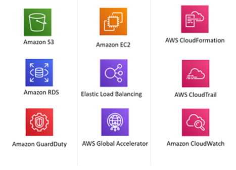
Geocgi is an ArcGIS Cloud Specialty preferred Esri partner with ArcGIS Enterprise in cloud environments. We are an AWS Select Consulting Partner and can meet client objectives with AWS, Microsoft Azure, and hybrid-cloud environments. We staff AWS Cloud Practitioners, AWS Solutions Architects, AWS Developers, and Esri Enterprise Administration Associates.

We’re a team with diverse interests and unique personalities that shares a love of GIS and a passion for entrepreneurship. And while we’re made up of more than our management team, these are the guys and gals that get paid to take your calls, so feel free to reach out.
President
Questions the necessity of any meeting that isn’t a “lunch meeting”.
Vice President/OCONUS Programs Lead
Saving the world. . . one rescue animal at a time.
Director of Operations/Federal Programs Lead
Makes maps for weekend bar crawls.
Director of Programs/Marine Corps Programs Lead
Photios George Katsourakis. DNA kit not required.
Director of Administration and Human Resources
More interested in what your dog did over the weekend.
Director of IT/IT Programs Lead
Fountain of useless knowledge.
Director of Business Development
Not sure if Burning Man is right for you? Ask Jason.
Solutions Manager
I’m not oblivious, I just don’t care.
Program Manager/Navy and Environmental Programs Lead
Big picture problem identifier. . .looking for volunteer solution identifiers.
sUAS Lead
Knows the exact height at which grass becomes a terrorist threat.
Program and Operations Manager
Program Manager
I don’t need approval for my dad jokes; the eyerolls are all the validation I need.
Operations Analyst
Will argue that a workday nap is a strategic recharge.
Our goal is to bring talented people together and create something that makes us all proud. We are friends and we are family. We look out for each other and our company culture and benefits are designed to reflect that.


We want you happy and healthy - we cover 100% of employee medical, vision, and dental plan premiums. We also think it's never too early or too late to help you reach your long term financial goals, so we contribute 3% on top of your salary into your 401k - regardless of your contribution.
We want you to be motivated and engaged so we offer flexible hours along with opportunities to work remotely. Take time off when you need it and then come back refreshed and ready to crush it with your team.


We are situated in one of the coolest, family friendly neighborhoods in the DC Metro area. Our office is accessible and walkable to public transportation, restaurants, and parks.
We don't take ourselves too seriously and our office space reflects that. It is unique, comfortable, and a relaxing environment. Cook lunch in our full kitchen or on the grill out back. Bring your dog. Kick off your shoes - we've got slippers!


We think it's important to never stop learning and growing. Take advantage of our tuition and continuing education reimbursements. Step outside of your box and take on a research and development project. Participate in our mentorship program. Attend a conference. Go and do!
When we need a break, we throw darts or put together a spontaneous bbq. We have regular team lunches and happy hours too. In short, we love hanging out together and having a good time.
Many of our positions require individuals with knowledge in geospatial data management, analysis, visualization, and the following experience:
geocgi provides equal employment opportunities to all employees and applicants for employment and prohibits discrimination and harassment of any type without regard to race, color, religion, age, sex, national origin, disability status, genetics, protected veteran status, sexual orientation, gender identity or expression, or any other characteristic protected by federal, state, or local laws.
At geocgi we pride ourselves on not losing our focus. We started out and remain GIS experts (or geeks. . . depending on your perspective). Since 2006, we’ve evolved into a world-class and world-wide service provider of multiple disciplines. We are a talented, hardworking group that share values and characteristics that drive client, professional, and personal success. geocgi is looking for a GIS Intelligence Data Manager to provide technical support for the NATO Supreme Headquarters Allied Powers Europe (SHAPE) Program. The GIS Intelligence Data Manager for NATO (SHAPE) will be responsible for publishing geospatial services, performing GIS-based data analysis, curating metadata, and ensuring effective communication with stakeholders across various technical domains. The position’s primary location is onsite at NATO Supreme Headquarters Allied Powers Europe (SHAPE) near Mons, Belgium.
Apply or Learn MoreAt geocgi we pride ourselves on not losing our focus. We started out and remain GIS experts (or geeks. . . depending on your perspective). Since 2006, we’ve evolved into a world-class and world-wide service provider of multiple disciplines. We are a talented, hardworking group that share values and characteristics that drive client, professional, and personal success. geocgi is looking for a GIS Analyst to support the USMC’s Installation Service Branch (ISB) Data Center in Kansas City, MO. The GIS Analyst will join a dynamic GIS team, serving the installation management community by providing GIS data, products, and services. As a member of the GIS team the candidate will support help desk activities, services and portal administration, and general troubleshooting. The candidate must have a foundational understanding of GIS concepts, formats, systems, and best practices. The primary location for this position is Kansas City, MO, with the option for a hybrid work schedule.
Apply or Learn Moregeocgi is seeking an experienced Associate Geospatial Data Manager to oversee and support the United States Air Force Geospatial Program at Scott Air Force Base, Illinois (St. Louis area). The Associate Geospatial Data Manager will be responsible by managing, organizing, and maintaining the integrity of geospatial and related datasets. This role involves data processing, quality control, and implementing best practices for data security and accessibility. The ideal candidate will have experience in geospatial data management, database systems, and familiarity with United States Air Force or Department of Defense (DoD) data security protocols. This position’s location is at Scott Air Force Base in Illinois (St. Louis area).
Apply or Learn Moregeocgi is seeking a skilled Geospatial Database Administrator to provide database management support for geospatial systems for the United States Air Force Program at Scott Air Force Base, Illinois (St. Louis area). The Geospatial Database Administrator will manage PostgreSQL and Oracle databases to support geospatial systems for Air Force missions, ensuring database integrity, performance, security, and compliance with DoD standards, while leading migration efforts from Oracle to PostgreSQL. The Geospatial Database Administrator will also focus on implementing Security Technical Implementation Guides (STIGs) quarterly. This position’s location is at Scott Air Force Base in Illinois (St. Louis area).
Apply or Learn Moregeocgi is seeking a skilled Junior Geospatial Systems Administrator to support administration and maintenance of geospatial systems for the United States Air Force Program at Scott Air Force Base, Illinois (St. Louis area). The Junior Geospatial Systems Administrator will manage the Esri ArcGIS Enterprise infrastructure and related technologies deployed on Amazon Web Services (AWS) cloud infrastructure. The Junior Geospatial Systems Administrator will also provide desktop support for U.S. Air Force users, perform backups, upgrades, maintenance and patches on Esri’s Enterprise infrastructure and other related applications on Windows-based systems. This position’s location is at U.S. Scott Air Force Base in Illinois (St. Louis area).
Apply or Learn Moregeocgi is looking for a ArcGIS Enterprise Administrator to provide technical support for the NATO Communications and Information Agency (NCIA) Geospatial Services Branch. The ArcGIS Enterprise Administrator will be responsible for modernizing NATO’s enterprise GIS system throughout the region. The ArcGIS Enterprise Administrator will install/upgrade, configure, test, and document ArcGIS Enterprise from version 10.8 to 11.3 and again thereafter; upgrade and manage ArcGIS Server; upgrade and/or migrate Portal for ArcGIS content, and administer enterprise geodatabases. Information technology environments are anticipated to be on-premises and then Azure cloud. This position includes significant support around load balancing, IIS, firewall configuration, network hardening, DNS configuration, patch management, sFTP/FTP, security policy configuration, and best practices.
Apply or Learn Moregeocgi is looking for a GIS Analyst to support a large U.S. Federal agency GIS program. Candidates will be responsible for geospatial data layer creation and maintenance, visualization and analysis support, space utilization data management, and technical documentation. The Analyst will work as part of a team that provides specialized programmatic support including Spatial Data Standards for Facilities, Infrastructure and Environment (SDSFIE) standards, geospatial integration, and business requirements gathering.
Apply or Learn Moregeocgi is looking for a GIS Technician to support a large U.S. Federal agency GIS program. The GIS Technician will work as part of a team that provides specialized programmatic support including Spatial Data Standards for Facilities, Infrastructure and Environment (SDSFIE) standards, geospatial data creation and integration, and business requirements gathering.
Apply or Learn MoreForeign Applicants: sorry, but the nature of our work requires a U.S. citizenship and we are unable to sponsor applicants at this time. geocgi is an affirmative action/equal opportunity employer.